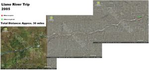
thanks to matt, i downloaded this program that will let you view any place in the world using satellite imaging. so i decided to make a little visual aid to let all of you know how far my kayaking trip is going to actually be. It's going to take 5 days to complete. check it out (click on the pic to see the larger view):
Trip Summary


isn't that just awesome, for the past two nights, i've sat for hours playing on it. looking at the pyramids in egypt. the great wall of china, machu piccu in peru.it has good clarity and a great zoom and tilt feature to view the elevation of the land. it's just so awesome.


3 comments:
that is kickin'. should be a great adventure. do you have a good helmet?
i need a helmet? crap!
Looks great. Five days out of touch with the world.. nice.
Post a Comment